
Highlights
- Cross three iconic high passes: Kongma La (5,535m), Cho La (5,420m), and Renjo La (5,360m).
- Summit Gokyo Ri (5,357m) and Kala Patthar (5,545m) for unparalleled panoramic views of Mount Everest.
- Explore the pristine turquoise waters of the Gokyo Lakes system.
- Stand at Everest Base Camp, the gateway to the roof of the world.
- Traverse the massive Ngozumpa Glacier, the longest glacier in the Himalayas.
- Experience the authentic Sherpa culture of the Khumbu region.
Everest Three Pass Trek
The Everest Three Passes Trek is the ultimate high-altitude adventure for those seeking to experience the Himalayas in their most raw and majestic form. Going beyond the classic Everest Base Camp route, this 20-day expedition takes you deep into the heart of the Sagamartha National Park, crossing three challenging passes: Kongma La (5,535 m), Cho La (5,420 m), and Renjo La (5,360 m).
This circuit offers a complete immersion into the Sherpa highlands. You will traverse rugged trails, cross massive glaciers, and stand on summits that offer some of the most spectacular mountain vistas on Earth. From the emerald depths of the Gokyo Lakes to the shadow of Everest itself at Base Camp, every day presents a new landscape of ice, rock, and sky.
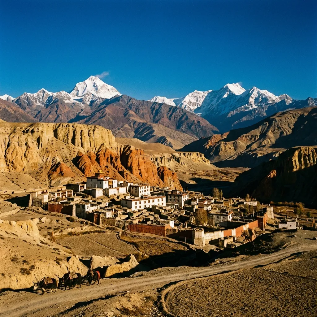
Route Map
Itinerary
Day 1: Kathmandu to Ramechhap
Kathmandu → Ramechhap
Drive: 5 hours | Elevation: 1,305m
The journey begins with a scenic drive from Kathmandu to Ramechhap, escaping the city bustle for the tranquility of the countryside. As the road winds through rural villages and terraced fields, you'll catch your first glimpses of the distant Himalayas.
Day 2: Flight to Lukla & Trek to Phakding
Leg 1: Ramechhap → Lukla
Flight: 1 hours | Elevation: 2,840m
Board a Twin Otter aircraft for the thrilling flight to Lukla, landing at the legendary Tenzing-Hillary Airport.
Leg 2: Lukla → Phakding
Trek: 5 hours, 8 km | Elevation: 2,650m
After meeting our crew, begin the trek along the Dudh Koshi River through pine forests and small Sherpa settlements, crossing swaying suspension bridges adorned with prayer flags.
Day 3: Phakding to Namche Bazaar
Leg 3: Phakding → Namche Bazaar
Trek: 7 hours, 12 km | Elevation: 3,440m
Enter the Sagarmatha National Park. The trail follows the river, crossing the iconic Hillary Suspension Bridge before the steep ascent to Namche Bazaar. Keep an eye out for your first view of Mount Everest peering over the Lhotse-Nuptse ridge.
Day 4: Acclimatization in Namche Bazaar
Acclimatization: 4 hours | Elevation: 3,440m
Acclimatization is key. Hike up to the Everest View Hotel for a panoramic lunch with views of Ama Dablam and Everest, then visit the Sherpa Culture Museum.
Day 5: Namche Bazaar to Tengboche
Leg 4: Namche Bazaar → Phunki Tenga
Trek: 2 hours, 5 km | Elevation: 3,250m
The trail to Tengboche offers constant views of the Everest massif. Descend to cross the river at Phunki Thenga.
Leg 5: Phunki Tenga → Tengboche
Trek: 4 hours, 4 km | Elevation: 3,860m
A challenging climb through rhododendron forests leads to Tengboche, famous for its monastery. Witnessing the monks' evening prayers with Ama Dablam towering behind is unforgettable.
Day 6: Tengboche to Dingboche
Leg 6: Tengboche → Pangboche
Trek: 2 hours, 4 km | Elevation: 3,985m
Descend through forest to the Imja Khola river. The landscape becomes more arid and alpine as we climb past Pangboche.
Leg 7: Pangboche → Dingboche
Trek: 4 hours, 6 km | Elevation: 4,410m
Continue to Dingboche, a patchwork of stone-walled fields protected from the cold wind, where we settle in for two nights.
Day 7: Acclimatization in Dingboche
Acclimatization: 5 hours | Elevation: 4,410m
A vital acclimatization day. Hike up Nangkartsang Peak (5,083m) for magnificent views of Makalu, Lhotse, Cho Oyu, and Island Peak.
Day 8: Dingboche to Chukkung
Leg 8: Dingboche → Chukkung
Trek: 5 hours, 5 km | Elevation: 4,730m
Head east into the Imja Valley with close-up views of Lhotse's massive south face and Ama Dablam's fluted ice walls. Chukkung is our launchpad for the first pass.
Day 9: Crossing Kongma La Pass to Lobuche
Leg 9: Chukkung → Kongma La Pass
Trek: 4 hours, 6 km | Elevation: 5,535m
Our first big challenge. Ascend steeply over loose rock to reach Kongma La. The view from the top is breathtaking, with glaciers and peaks surrounding us.
Leg 10: Kongma La Pass → Lobuche
Trek: 4 hours, 8 km | Elevation: 4,910m
Descend across the Khumbu Glacier—a dynamic landscape of ice and moraine—to reach Lobuche.
Day 10: Lobuche to Everest Base Camp
Leg 11: Lobuche → Gorak Shep
Trek: 3 hours, 5 km | Elevation: 5,164m
Follow the glacial moraine of the Khumbu Glacier north through rocky, desolate terrain to Gorak Shep.
Leg 12: Gorak Shep → Everest Base Camp
Trek: 4 hours, 5 km | Elevation: 5,364m
Standing at the foot of the Khumbu Icefall, where expeditions prepare for summit bids, is surreal. Return to Gorak Shep for the night.
Day 11: Kala Patthar Sunrise & Trek to Dzongla
Leg 13: Everest Base Camp → Kala Patthar
Trek: 2 hours, 3.3 km | Elevation: 5,545m
Pre-dawn climb to Kala Patthar. Watching the sun rise over Everest's summit is the quintessential Himalayan moment.
Leg 14: Kala Patthar → Dzongla
Trek: 5 hours, 10 km | Elevation: 4,830m
Descend for breakfast, then retrace steps to Lobuche and turn west to reach the quiet outpost of Dzongla.
Day 12: Crossing Cho La Pass to Thagnak
Leg 15: Dzongla → Cho La Pass
Trek: 4 hours, 5 km | Elevation: 5,420m
The traverse of Cho La involves a steep, icy ascent. Micro-spikes may be needed for the glacier crossing. The pass offers a dramatic transition to the Gokyo valley.
Leg 16: Cho La Pass → Thagnak
Trek: 4 hours, 5 km | Elevation: 4,700m
Descend steeply into the Gokyo region for the night at Thagnak.
Day 13: Thagnak to Gokyo
Leg 17: Thagnak → Gokyo
Trek: 4 hours, 5 km | Elevation: 4,800m
Cross the massive Ngozumpa Glacier, Nepal's largest. The pristine turquoise Gokyo Lakes greet you on the other side. Gokyo village sits beneath Cho Oyu.
Day 14: Gokyo Ri & The Fifth Lake
Leg 18: Gokyo → Gokyo Ri
Trek: 2 hours, 3 km | Elevation: 5,357m
Early morning climb of Gokyo Ri offers arguably the finest panorama in the Khumbu—Everest, Lhotse, Makalu, and Cho Oyu in one wide arc.
Leg 19: Gokyo Ri → Fifth Lake
Trek: 2 hours, 3 km | Elevation: 4,990m
Afternoon hike to the Fourth and Fifth Lakes for views of the Everest North Face.
Leg 20: Fifth Lake → Gokyo
Trek: 1 hours, 4 km | Elevation: 4,800m
Return to Gokyo for the evening.
Day 15: Crossing Renjo La Pass to Lunden
Leg 21: Gokyo → Renjo La Pass
Trek: 4 hours, 15.6 km | Elevation: 5,360m
Our final high pass offers a stunning farewell view of Everest and the Gokyo lakes.
Leg 22: Renjo La Pass → Lunden
Trek: 4 hours, 6 km | Elevation: 4,300m
The descent leads into a remote valley rarely visited by trekkers. Reach Lunden, a traditional trading post on the route to Tibet.
Day 16: Lunden to Thame
Leg 23: Lunden → Thame
Trek: 5 hours, 10 km | Elevation: 3,800m
Descend into the Bhote Koshi valley past ancient stone walls and yak pastures. Thame is home to many famous Sherpa mountaineers. Visit the hilltop monastery.
Day 17: Thame to Namche Bazaar
Leg 24: Thame → Thamo
Trek: 2 hours, 4 km | Elevation: 3,500m
The trail contours the valley side through Thamo village and serene pine forests.
Leg 25: Thamo → Namche Bazaar
Trek: 2 hours, 5 km | Elevation: 3,440m
Complete the great circuit returning to Namche Bazaar. Celebration dinner and perhaps a hot shower!
Day 18: Namche Bazaar to Lukla
Leg 26: Namche Bazaar → Lukla
Trek: 7 hours, 20 km | Elevation: 2,840m
Final trekking day following the Dudh Koshi downstream. Cross the suspension bridges one last time and exit the national park. Time to reflect on the incredible journey.
Day 19: Flight to Ramechhap & Drive to Kathmandu
Lukla → Ramechhap
Flight: 1 hours | Elevation: 1,305m
Morning flight out of Lukla for the thrilling descent to Ramechhap.
Ramechhap → Kathmandu
Drive: 5 hours | Elevation: 1,305m
Drive from Ramechhap back to Kathmandu for a well-deserved rest.
Journey Gallery
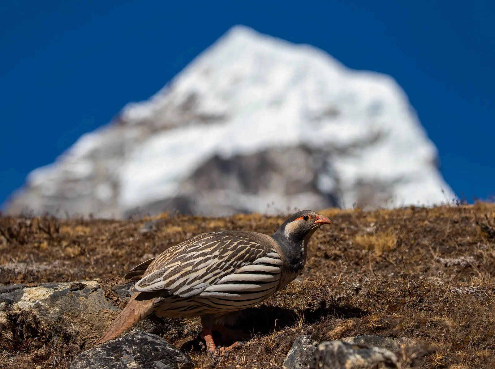 Himalayan Snowcock
A Himalayan snowcock forages on the rocky alpine ground with a snow-capped peak rising against a deep blue sky.
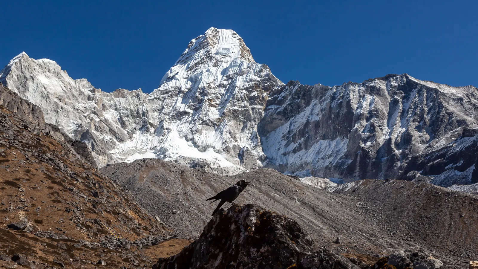 Ama Dablam
The striking pyramid of Ama Dablam rises above the rocky moraine with an alpine chough silhouetted on a boulder.
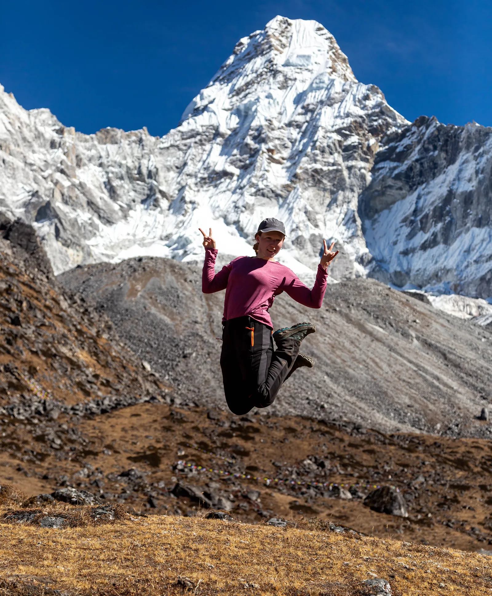 Joy at Ama Dablam
A trekker leaps into the air with peace signs as the towering face of Ama Dablam rises behind.
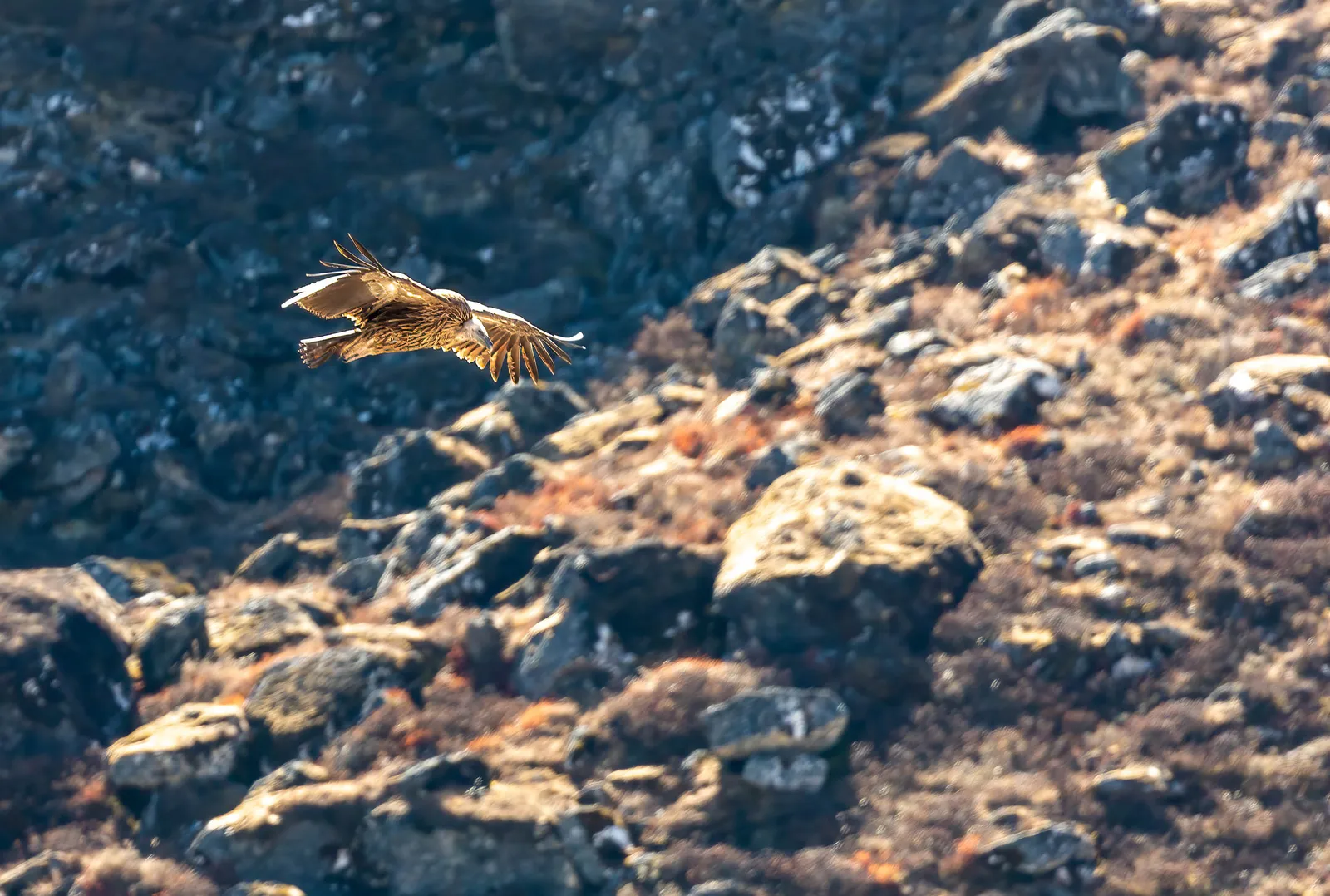 Himalayan Griffon in Flight
A Himalayan griffon vulture glides low over the sunlit rocky slopes of the Khumbu.
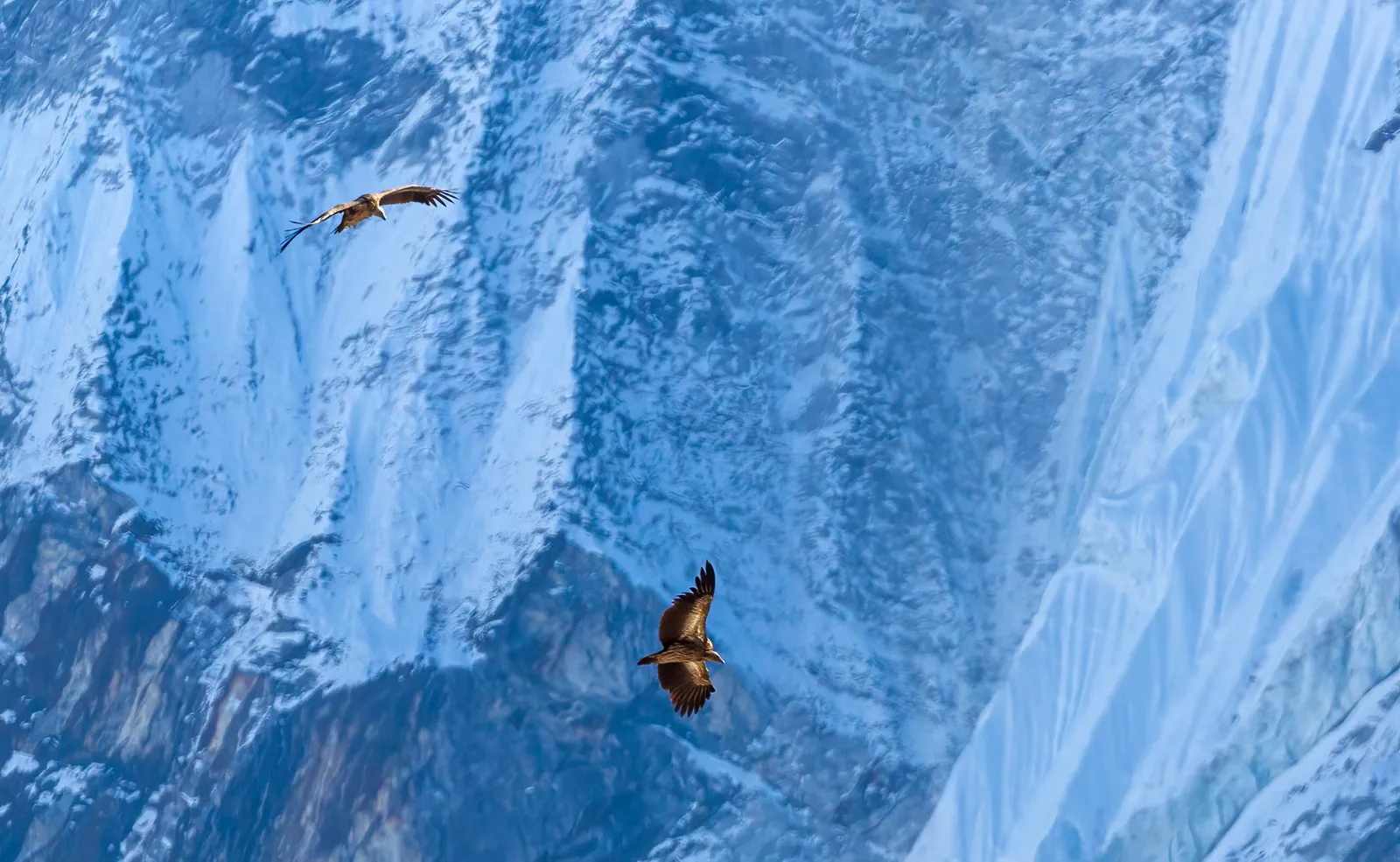 Vultures Over the Himalaya
Two Himalayan griffon vultures soar against the massive ice-streaked face of a Himalayan peak.
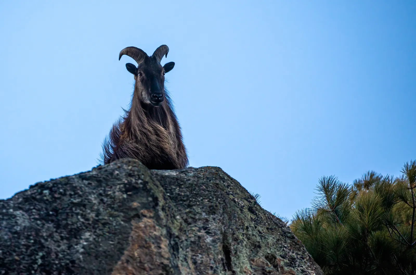 Himalayan Tahr
A Himalayan tahr with its dark mane and curved horns peers over a moss-covered boulder beside pine branches.