Highlights
- Traverse the remote and culturally rich Manaslu Conservation Area.
- Witness the majestic Mt. Manaslu (8,163m), the 'Mountain of the Spirit'.
- Experience the unique Tibetan-influenced culture of Nubri and Tsum Valleys.
- Cross the dramatic Larkya La Pass (5,160m) for panoramic Himalayan views.
- Walk along the precipitous Budi Gandaki river gorge.
- Visit the ancient Ribung Gompa and other serene monasteries.
Manaslu Circuit Trek
The Manaslu Circuit Trek is widely regarded as the finest all-round trek in Nepal. Less crowded than the Annapurna Circuit or Everest Base Camp, it offers a genuine wilderness experience combined with deep cultural immersion. The route circles the majestic Mt. Manaslu (8,163m), the eighth-highest mountain in the world, known locally as the “Mountain of the Spirit.”
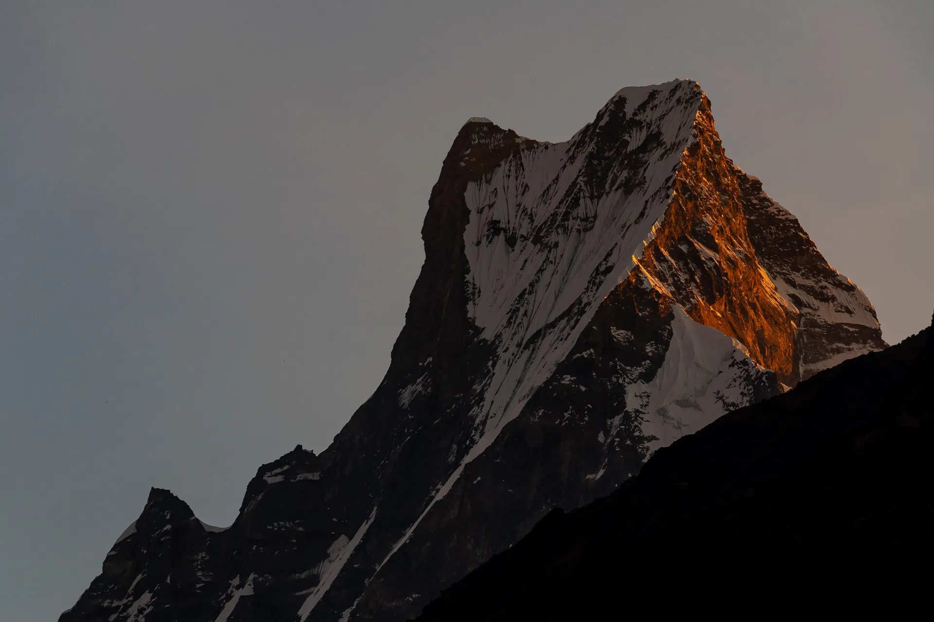
Starting from the humid lowlands, the trail follows the thundering Budi Gandaki River upstream, passing through narrow gorges and lush forests. As you ascend, the landscape transforms into an alpine wonderland of glaciers and snow-capped peaks. The journey takes you through culturally Tibetan villages like Samagaon and Samdo, where ancient traditions remain untouched by modernity. The highlight of the trek is the challenging crossing of the Larkya La Pass (5,160m), stunning unparalleled views of Himlung Himal, Cheo Himal, and the massive Annapurna II.
Route Map
Itinerary
Day 1: Kathmandu to Machha Khola
Leg 1: Kathmandu → Machha Khola
Drive: 10 hours | Elevation: 900m
Scenic drive from Kathmandu. Leaving the highway at Malekhu, we travel along winding mountain roads through Dhading Besi and Arughat. The road follows the Budi Gandaki river to Machha Khola, a small riverside village.
Day 2: Machha Khola to Dovan
Leg 2: Machha Khola → Tatopani
Trek: 3 hours, 8 km | Elevation: 980m
The trail follows the river gorge, ascending and descending over ridges. Cross the Tharo Khola and reach the hot springs at Tatopani for a relaxing break.
Leg 3: Tatopani → Dovan
Trek: 3 hours, 4 km | Elevation: 1,070m
Cross a suspension bridge over the Budi Gandaki and climb a stone staircase to reach Dovan.
Day 3: Dovan to Philim
Leg 4: Dovan → Jagat
Trek: 3 hours, 10 km | Elevation: 1,340m
Enter the Manaslu Conservation Area. The valley narrows into a dramatic gorge with steep cliff walls. Cross several suspension bridges and pass Jagat with its stone-paved streets.
Leg 5: Jagat → Philim
Trek: 3 hours, 8 km | Elevation: 1,570m
A steady climb brings you to the large Gurung village of Philim, known for its Japanese-built school and terraced fields.
Day 4: Philim to Deng
Leg 6: Philim → Deng
Trek: 6 hours, 14 km | Elevation: 1,860m
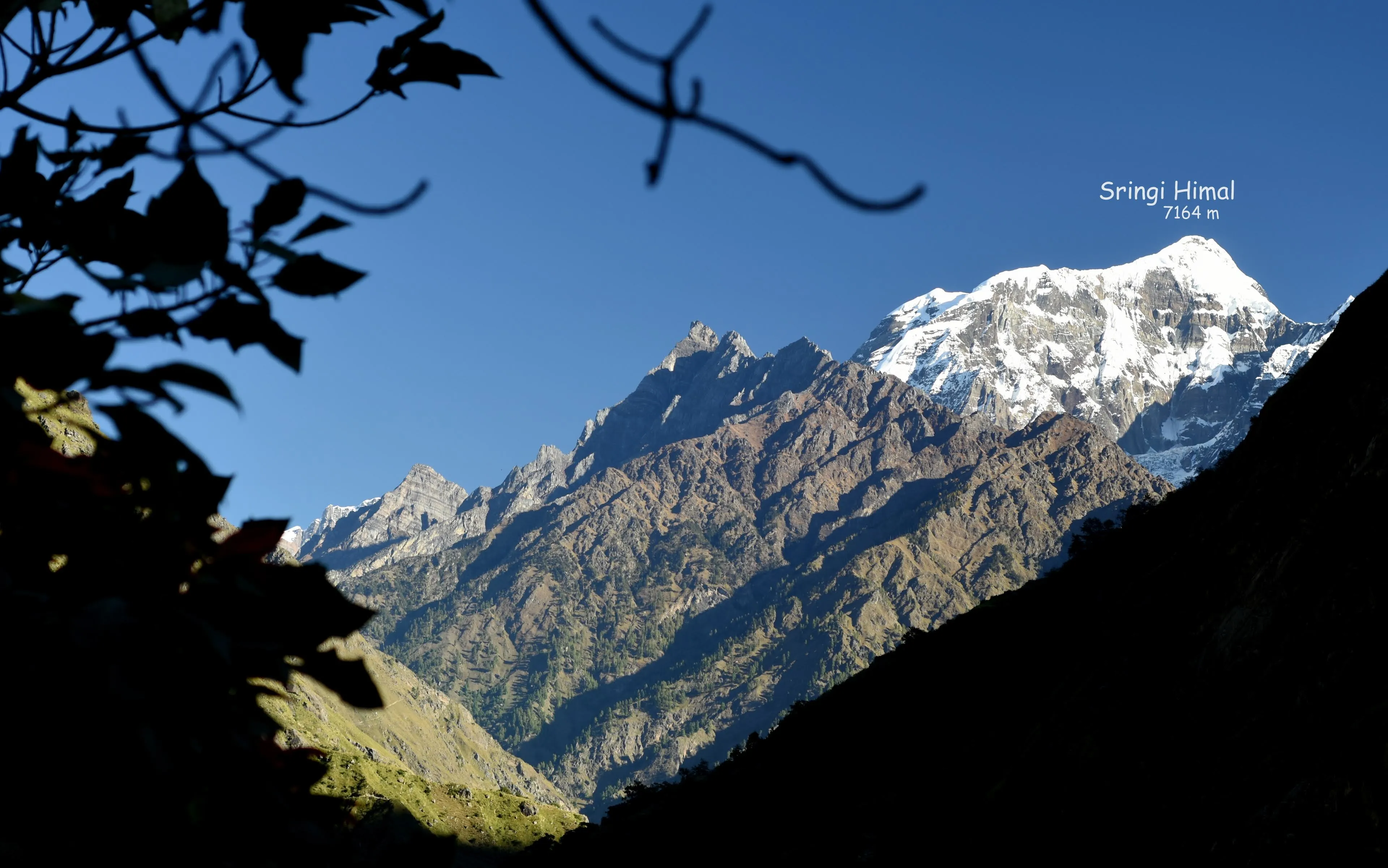
The trail winds through pine forests and passes through the narrow gorge. First signs of Buddhist culture appear with mani walls and prayer flags. Cross the river on a wooden bridge and climb through bamboo forests to Deng, with views of Shringi Himal.
Day 5: Deng to Ghap
Leg 7: Deng → Bihi Phedi
Trek: 2 hours, 6 km | Elevation: 2,100m
Cross to the west bank and climb through fir and rhododendron forests. The valley widens as you pass through Bihi Phedi.
Leg 8: Bihi Phedi → Prok
Trek: 1 hours, 4 km | Elevation: 2,200m
Continue through Prok village.
Leg 9: Prok → Ghap
Trek: 2 hours, 5 km | Elevation: 2,380m
Ghap is a beautiful settlement with intricate mani carvings and a distinct Tibetan feel.
Day 6: Ghap to Namrung
Leg 10: Ghap → Namrung
Trek: 6 hours, 8 km | Elevation: 2,630m
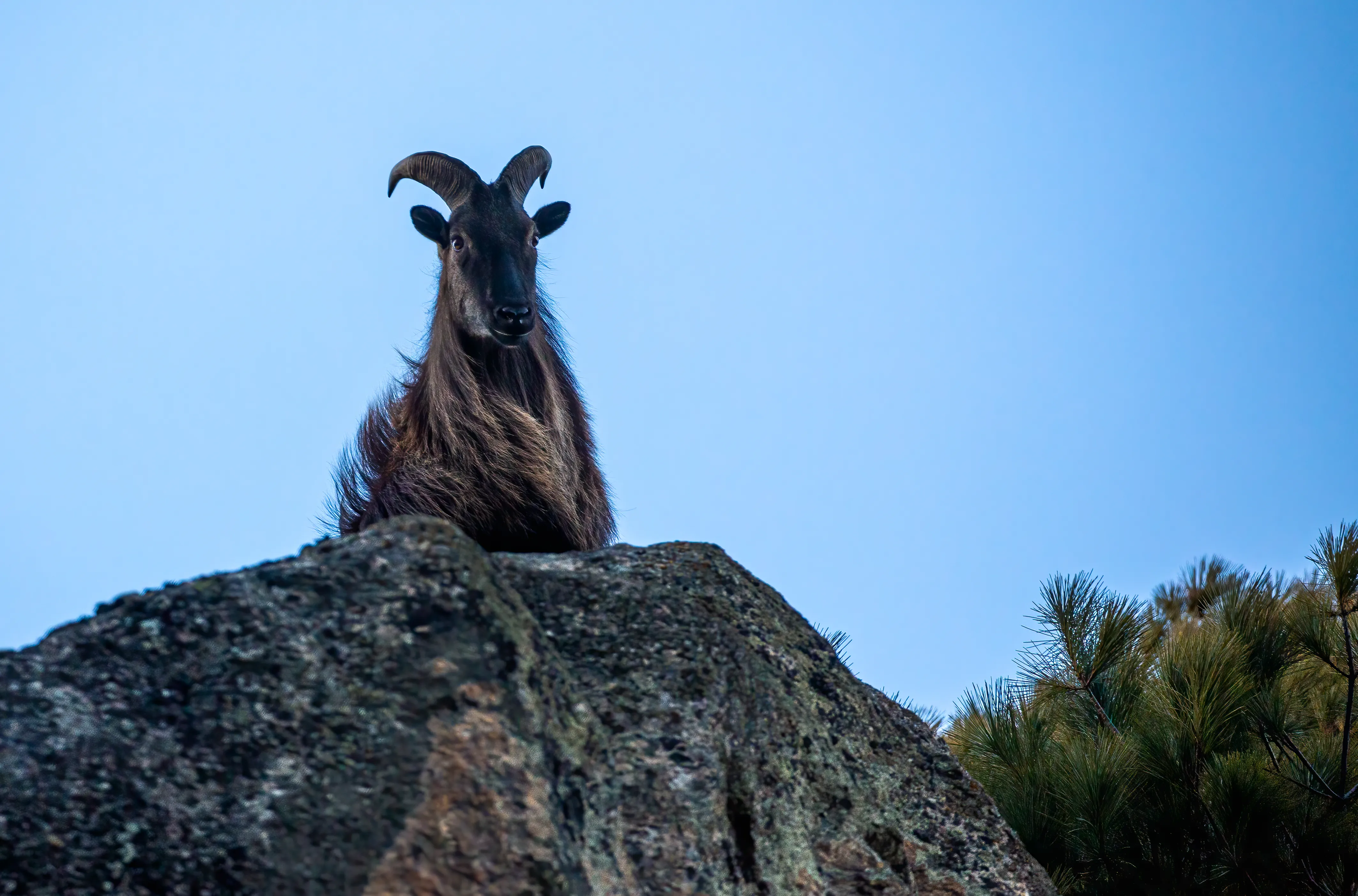
A steady climb through heavy forest, home to langur monkeys and diverse birdlife. As you gain altitude, the air becomes crisp. Namrung is the viewpoint where you get your first spectacular close-up view of Mt. Manaslu and Manaslu North.
Day 7: Namrung to Lho Gaon
Leg 11: Namrung → Lihi
Trek: 2 hours, 5 km | Elevation: 2,920m
The scenery becomes truly alpine. Pass through Lihi, known for its chortens and barley terraces.
Leg 12: Lihi → Lho Gaon
Trek: 2 hours, 5 km | Elevation: 3,180m
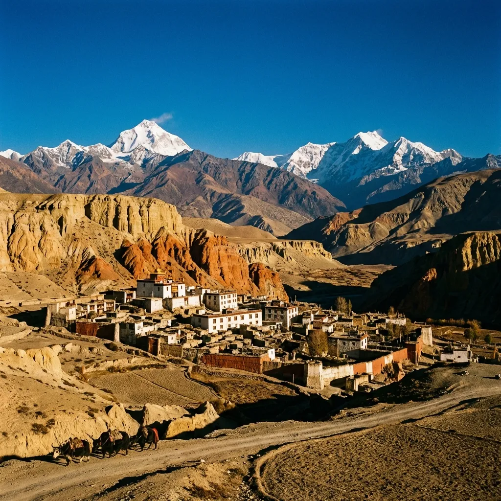
The trail climbs to Lho, a large village dominated by the majestic Ribung Gompa. The view of Manaslu rising directly above the village is one of the most iconic sights of the trek.
Day 8: Lho Gaon to Sama Gaon
Leg 13: Lho Gaon → Shyala
Trek: 2 hours, 4 km | Elevation: 3,400m
A short but visually stunning day. Walk through mossy forest to Shyala, surrounded by high peaks like Himal Chuli and Peak 29.
Leg 14: Shyala → Sama Gaon
Trek: 2 hours, 4 km | Elevation: 3,530m
A final easy walk brings you to Sama Gaon, the principal village of the Nubri Valley. It sits at the foot of the Manaslu glacier and feels like a step back in time.
Day 9: Acclimatization in Sama Gaon
Acclimatization: 5 hours | Elevation: 3,530m
Rest and acclimatize. Options include hiking to Pungyen Gompa for a secret view of the Manaslu glacier, visiting glacial Birendra Tal lake, or trekking partway to Manaslu Base Camp.
Day 10: Sama Gaon to Samdo
Leg 15: Sama Gaon → Samdo
Trek: 4 hours, 8.5 km | Elevation: 3,860m
The trail winds north along the Budi Gandaki. Leave the tree line behind and enter the arid, wind-swept high valley. Samdo is the highest permanent settlement, close to the Tibetan border and a traditional trading post for yak caravans.
Day 11: Samdo to Dharamsala (Larkya Phedi)
Leg 16: Samdo → Dharamsala
Trek: 4 hours, 12 km | Elevation: 4,460m
A short day to prepare for the pass. Cross the Gyala Khola and climb steadily uphill through barren, rugged landscape dominated by the massive Larkya Glacier. Dharamsala is a stone guest house serving as base camp for the pass.
Day 12: Crossing Larkya La Pass to Bimthang
Leg 17: Dharamsala → Larkya La Pass
Trek: 4 hours, 6 km | Elevation: 5,160m
The biggest day! Start pre-dawn, climbing steeply along the moraine. The ascent is tough but non-technical. Reaching the prayer flags of Larkya La Pass, the view is unforgettable: Himlung Himal, Cheo Himal, Kang Guru, and the Annapurna range.
Leg 18: Larkya La Pass → Bimthang
Trek: 5 hours, 13 km | Elevation: 3,720m
The descent is steep and icy, leading into the beautiful forested valley of Bimthang.
Day 13: Bimthang to Dharapani
Leg 19: Bimthang → Gho
Trek: 4 hours, 12 km | Elevation: 2,515m
Drop quickly from the alpine zone back into lush sub-tropical forests. The trail follows the Dudh Khola, passing through rhododendron and oak forests to the village of Gho.
Leg 20: Gho → Dharapani
Trek: 4 hours, 12 km | Elevation: 1,860m
Continue to Dharapani, where our trail joins the Annapurna Circuit route.
Day 14: Drive to Kathmandu
Dharapani → Kathmandu
Drive: 10 hours | Elevation: 1,400m
Take a jeep from Dharapani to Besisahar, then transfer to a vehicle for the drive back to Kathmandu. Relax and reflect on the incredible journey you've just completed.
Journey Gallery
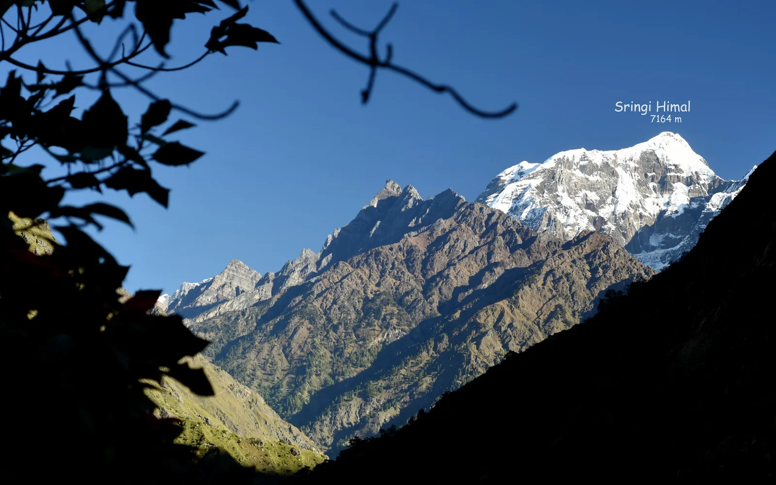 Sringi Himal
The snow-capped peak of Sringi Himal (7,164m) rises above the forested valley, framed by silhouetted tree branches.
 Village Children
A girl concentrates on writing while a toddler plays near woven baskets and stacked firewood in a mountain village courtyard.
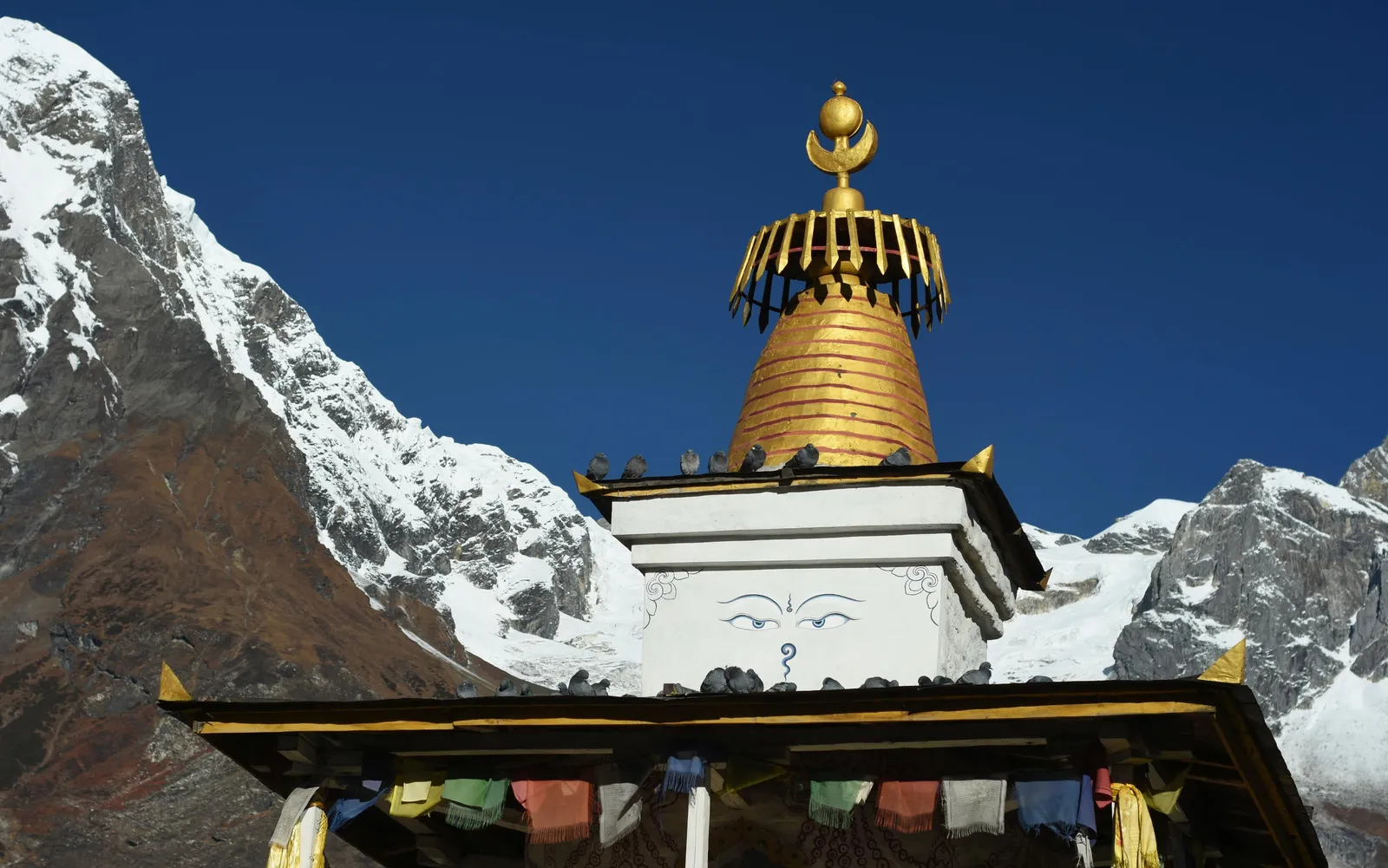 Buddhist Stupa
A golden Buddhist stupa with painted wisdom eyes stands beneath snow-capped peaks, with colorful prayer flags strung below.
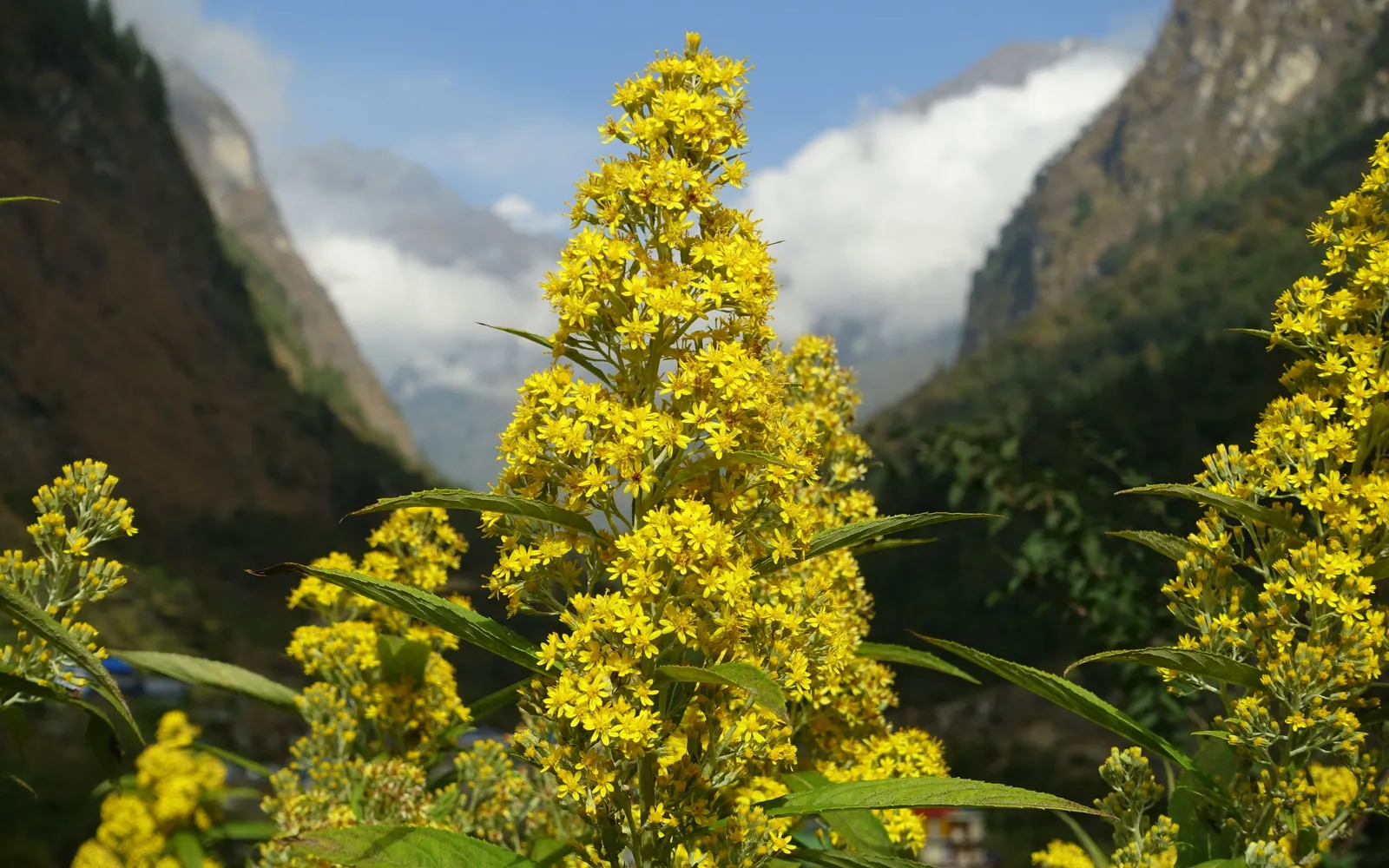 Mountain Wildflowers
Bright yellow wildflowers bloom in the foreground with the mountain valley and clouds filling the gorge behind.