Highlights
- Explore the hidden Tsum Valley, a sacred Tibetan Buddhist pilgrimage site.
- Visit the ancient Mu Gompa and Rachen Gompa monasteries.
- Meditate at Milarepa's Cave, where the legendary Tibetan saint practiced.
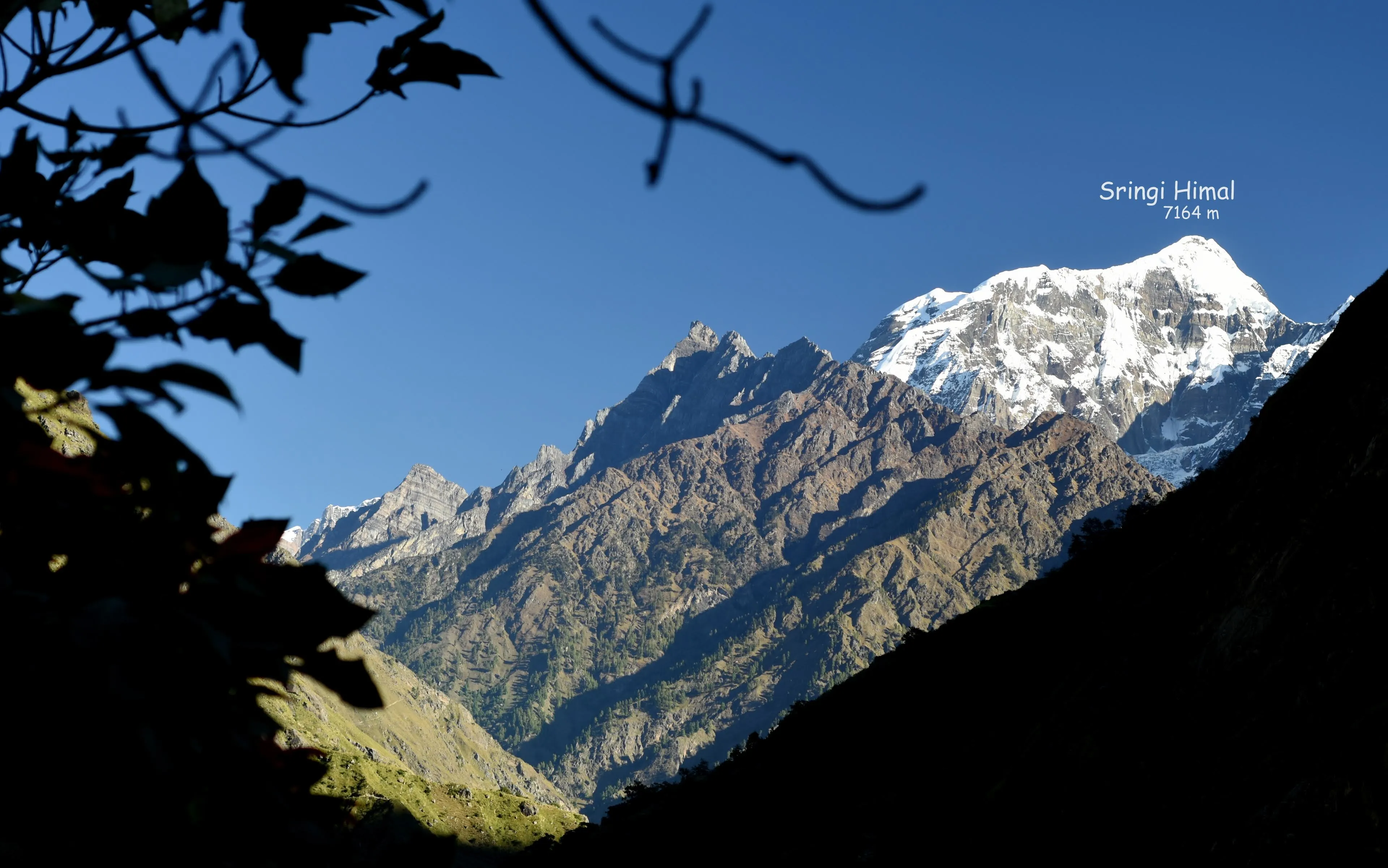
- Witness stunning views of Ganesh Himal, Sringi Himal, and Baudha Himal.
- Experience authentic Tibetan culture and warm village hospitality.
- Trek through diverse landscapes from subtropical forest to high-altitude desert.
Tsum Valley Trek
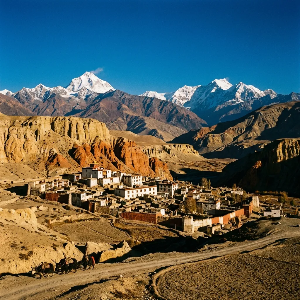
The Tsum Valley Trek is a journey into one of Nepal’s most sacred and culturally preserved regions. Hidden at the base of Manaslu Mountain, the Tsum Valley was closed to outsiders until 2008, allowing its Tibetan Buddhist culture to remain virtually unchanged for centuries. The valley’s name derives from the Tibetan word “Tsombo,” meaning vivid, and the landscape lives up to this description—a dramatic realm of snow peaks, ancient monasteries, and villages where prayer wheels spin and chortens line every trail.
The trek begins with a long drive from Kathmandu to Machha Khola, then follows the Budi Gandaki River through lush subtropical forest. As you ascend, the landscape transforms: rice paddies give way to barley fields, Hindu villages transition to Buddhist settlements, and the architecture shifts to traditional Tibetan stone houses with flat roofs. The cultural highlight is Mu Gompa, the valley’s most important monastery, where monks have practiced for generations and the views of the surrounding peaks are breathtaking.
Along the way, you’ll visit Milarepa’s Cave, where the legendary Tibetan saint meditated, and experience the warm hospitality of villagers who maintain traditions passed down through countless generations. The Tsum Valley offers a rare glimpse into a world that has changed little over the centuries—a sacred landscape where spirituality permeates every aspect of life.
Route Map
Itinerary
Day 1: Arrival in Kathmandu
Rest | Elevation: 1,305m
Welcome to Nepal. Transfer to your hotel and prepare for the adventure into one of the Himalaya's most sacred valleys.
Day 2: Drive to Machha Khola
Leg 1: Kathmandu → Machha Khola
Drive: 10 hours | Elevation: 900m
A long but scenic drive through the middle hills, following the Budi Gandaki River into the Manaslu region. The road becomes increasingly rugged as you travel deeper into the mountains. Machha Khola (Fish River) is named for the trout that once filled its waters.
Day 3: Trek to Jagat
Leg 2: Machha Khola → Tatopani
Trek: 3 hours, 8 km | Elevation: 980m
The trail follows the riverbank through subtropical forest, crossing suspension bridges and passing through small villages. Stop at the natural hot springs of Tatopani to soothe tired muscles.
Leg 3: Tatopani → Jagat
Trek: 4 hours, 10 km | Elevation: 1,340m
Continue to Jagat, where trekking permits are checked.
Day 4: Trek to Lokpa
Leg 4: Jagat → Philim
Trek: 3 hours, 8 km | Elevation: 1,570m
Signs of Buddhist culture become more prominent—mani walls, prayer flags, and chortens line the trail. The path climbs through Philim, a prosperous village surrounded by terraced fields.
Leg 5: Philim → Lokpa
Trek: 3 hours, 10 km | Elevation: 2,240m
Continue to Lokpa and its barley fields.
Day 5: Trek to Chumling
Leg 6: Lokpa → Chumling
Trek: 6 hours, 8 km | Elevation: 2,386m
The terrain steepens with views of the Sardi Gorge and distant peaks including Ganesh Himal and Baudha Himal. Cross the bridge into Chumling, the gateway to Tsum Valley proper, where you can visit monasteries including Panago Gompa.
Day 6: Trek to Chhokang Paro
Leg 7: Chumling → Chhokang Paro
Trek: 5 hours, 10 km | Elevation: 3,031m
Enter the heart of Tsum Valley. The landscape opens into a wide valley surrounded by snow peaks. Chhokang Paro sits on flat meadows, divided into two settlements with stunning views of Ganesh Himal. The Tibetan architecture—flat-roofed stone houses with intricate wood carvings—reflects centuries of tradition.
Day 7: Trek to Nile
Leg 8: Chhokang Paro → Rachen Gompa
Trek: 2 hours, 3 km | Elevation: 3,240m
Visit Rachen Gompa, a nunnery overlooking the valley.
Leg 9: Rachen Gompa → Milarepa Cave
Trek: 2 hours, 2 km | Elevation: 3,400m
Stop at the historic Milarepa Cave (Piren Phu), where the famous Tibetan saint once meditated.
Leg 10: Milarepa Cave → Nile
Trek: 2 hours, 3 km | Elevation: 3,361m
Continue to Nile, the highest village in the lower Tsum.
Day 8: Trek to Mu Gompa
Leg 11: Nile → Mu Gompa
Trek: 5 hours, 6 km | Elevation: 3,700m
The shortest but most rewarding day. The trail leads through increasingly arid terrain toward the Tibetan border. Mu Gompa, the largest monastery in Tsum Valley, sits in a spectacular location surrounded by mani walls and chortens. Explore the ancient gompa and meet the resident monks.
Day 9: Acclimatization at Mu Gompa
Acclimatization: 5 hours | Elevation: 3,700m
A day to explore and acclimatize. Visit the monastery, walk among the prayer wheels and mani walls, and soak in the profound spiritual atmosphere. Optional hike to viewpoints for panoramic mountain views.
Day 10: Trek to Burgi Village via Milarepa Cave
Leg 12: Mu Gompa → Burgi Village
Trek: 6 hours, 8 km | Elevation: 3,245m
Retrace your steps through Nile, then climb to Milarepa Cave for deeper exploration and spectacular views of Kipu Himal, Churke Himal, and the Poshyop Glacier. Continue to Burgi Village.
Day 11: Trek to Chumling
Leg 13: Burgi Village → Chumling
Trek: 6 hours, 14 km | Elevation: 2,386m
Descend through Chhokang Paro and back into the lower Tsum Valley. The return journey offers new perspectives on the dramatic landscape. Overnight in Chumling.
Day 12: Trek to Philim
Leg 14: Chumling → Philim
Trek: 7 hours, 13 km | Elevation: 1,570m
Continue the descent through Lokpa and the narrowing valley. Pass the impressive Samba Falls and cross multiple suspension bridges. Philim, with its strong Tibetan influence, marks the end of the trek for today.
Day 13: Trek to Khorlabesi
Leg 15: Philim → Khorlabesi
Trek: 7 hours, 30 km | Elevation: 970m
Descend through Tatopani for another soak in the hot springs. The vegetation becomes increasingly lush as you lose altitude. The Tibetan arid climate transitions to subtropical greenery. Overnight at Khorlabesi.
Day 14: Trek to Machha Khola
Leg 16: Khorlabesi → Machha Khola
Trek: 5 hours, 5 km | Elevation: 900m
The final trekking day follows the Budi Gandaki River back to Machha Khola, completing the circuit through the sacred Tsum Valley.
Day 15: Drive to Kathmandu
Machha Khola → Kathmandu
Drive: 10 hours | Elevation: 1,305m
The journey reverses through the winding mountain roads, offering final views of the peaks and valleys you've explored. Arrive in Kathmandu by evening.
Day 16: Departure
Rest | Elevation: 1,305m
Transfer to Tribhuvan International Airport for your onward journey, carrying memories of a sacred valley that few outsiders have experienced.
Journey Gallery
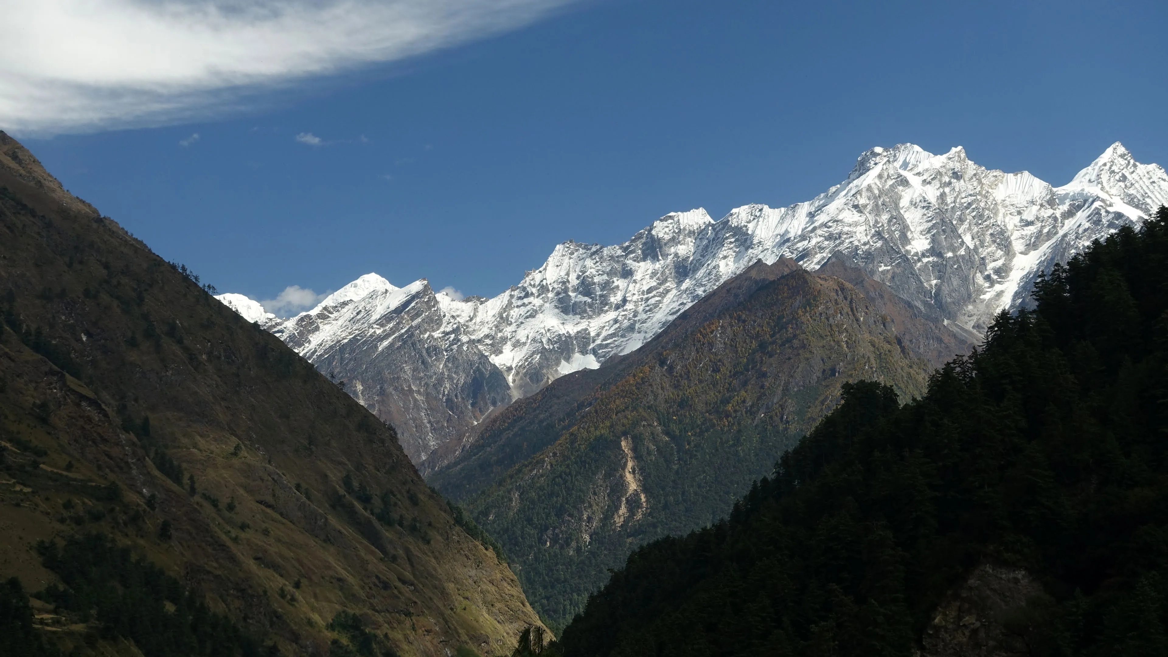
 Valley View
Snow-capped peaks rise at the head of the valley, framed by dark forested slopes on both sides.
 Mountain Teahouse
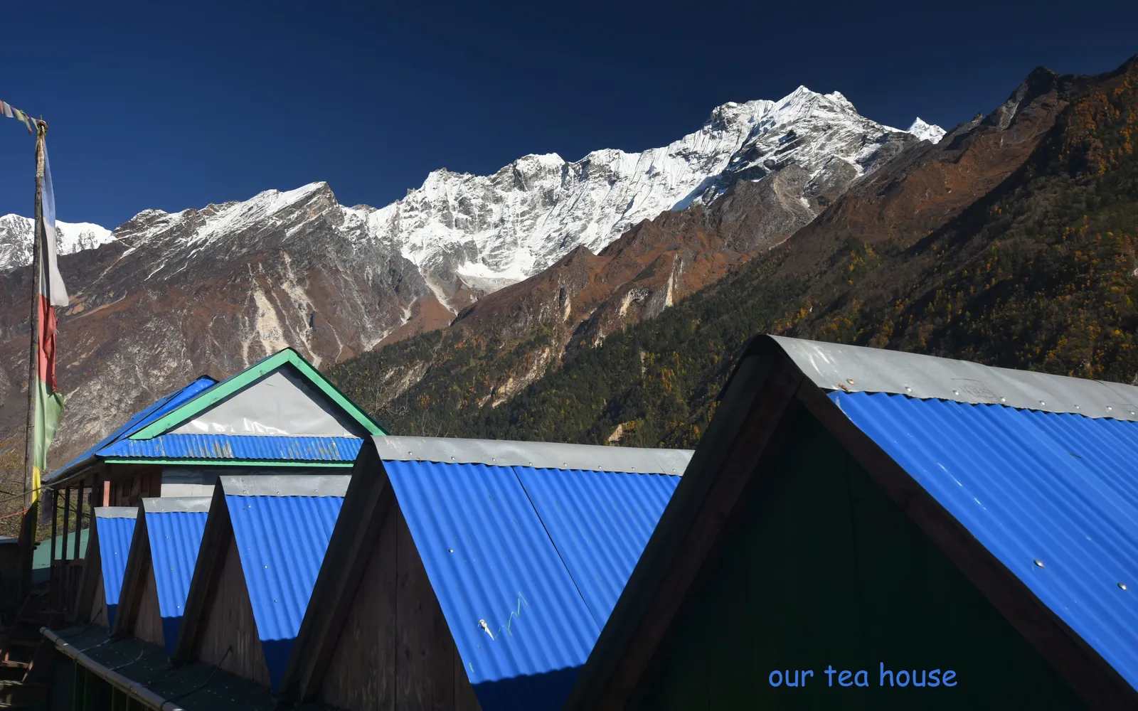
Blue tin-roofed teahouse buildings sit beneath towering snow-capped peaks, with a prayer flag pole rising above.
 Rest at the Chorten
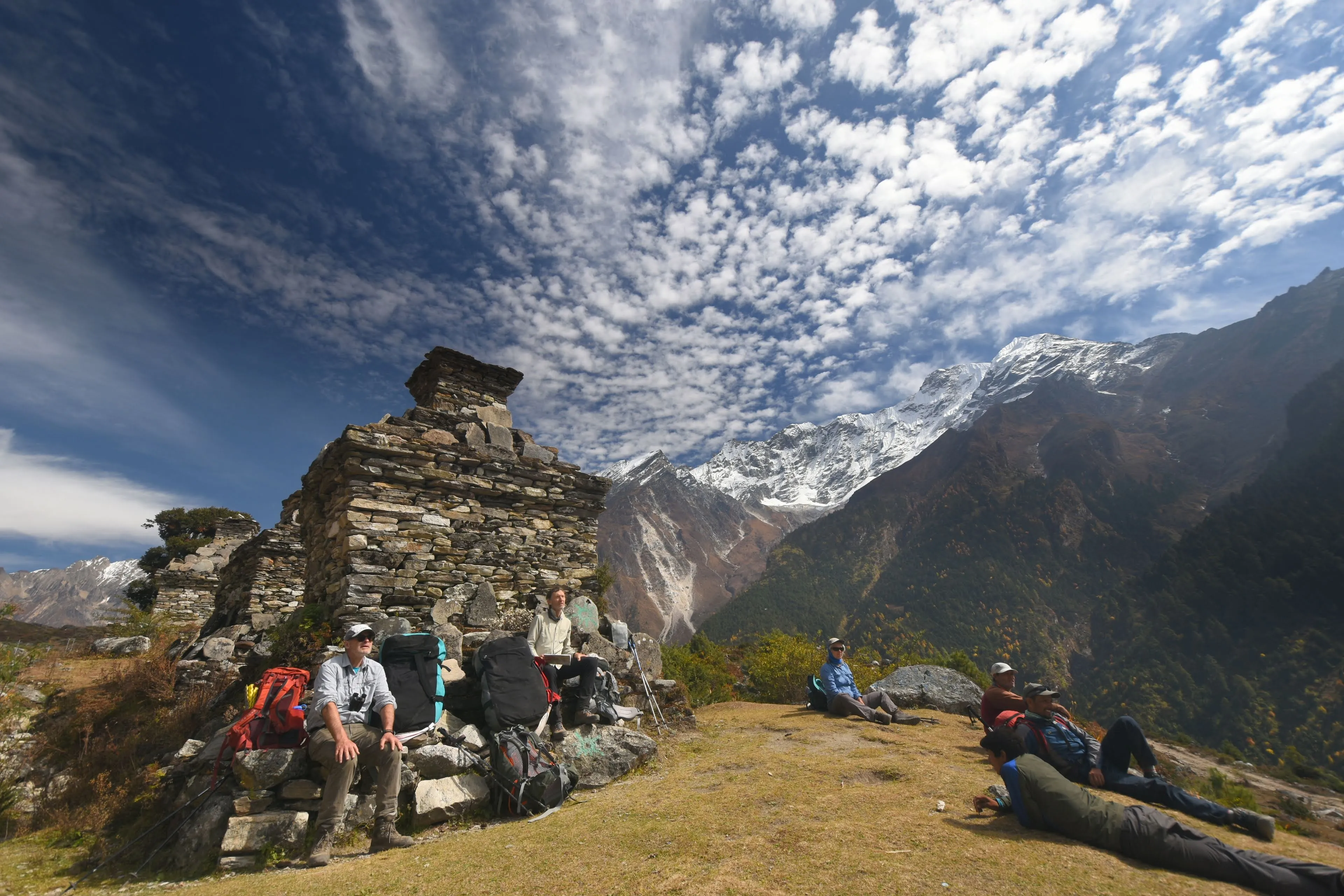
A group of trekkers rests beside an ancient stone chorten on a grassy hillside with snow peaks and dramatic clouds behind.
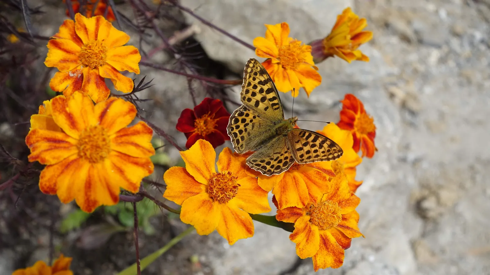 Mountain Butterfly
A fritillary butterfly rests on vibrant orange marigolds blooming beside the trail.
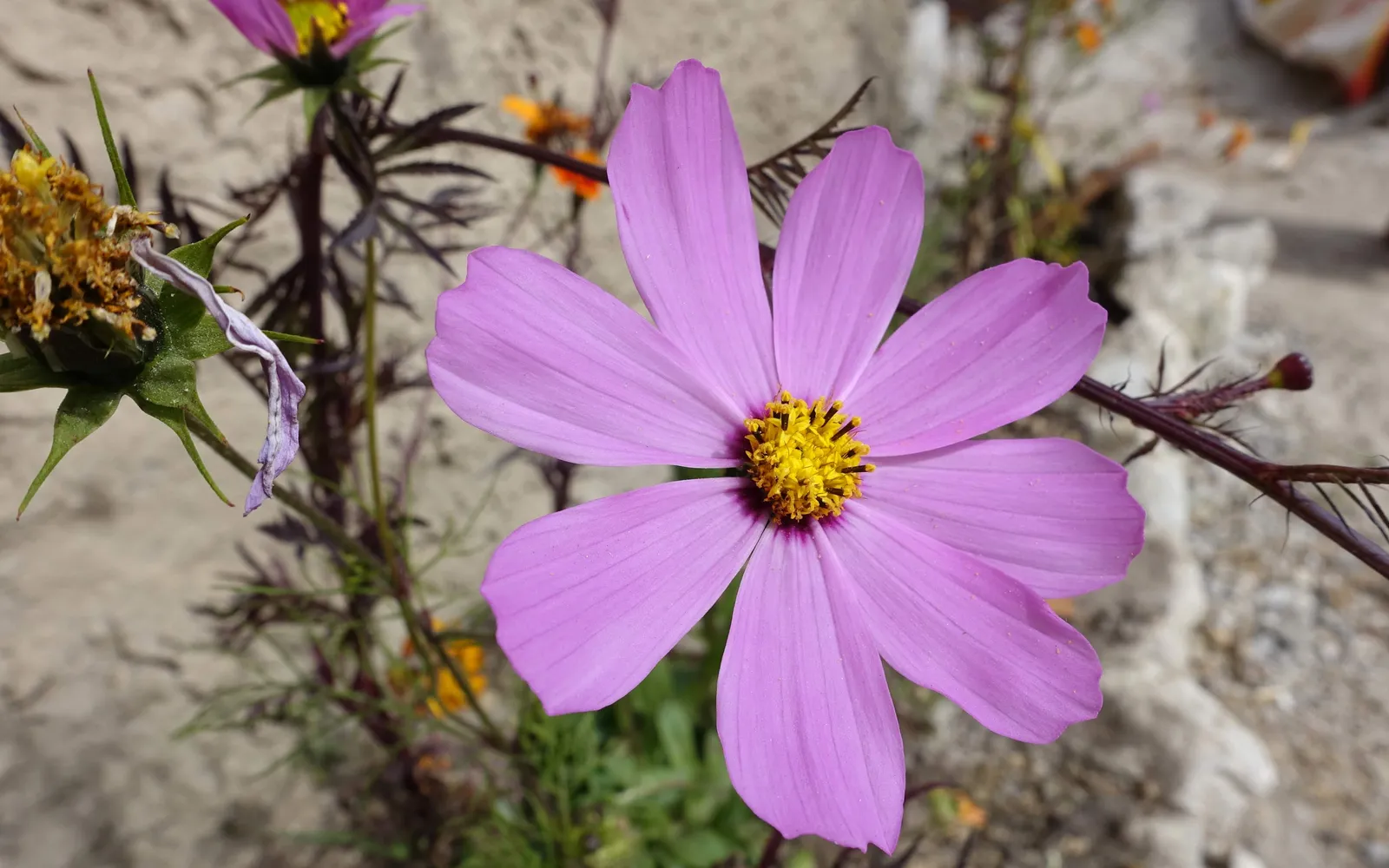 Cosmos in Bloom
A delicate pink cosmos flower blooms beside a stone wall in one of the valley's villages.
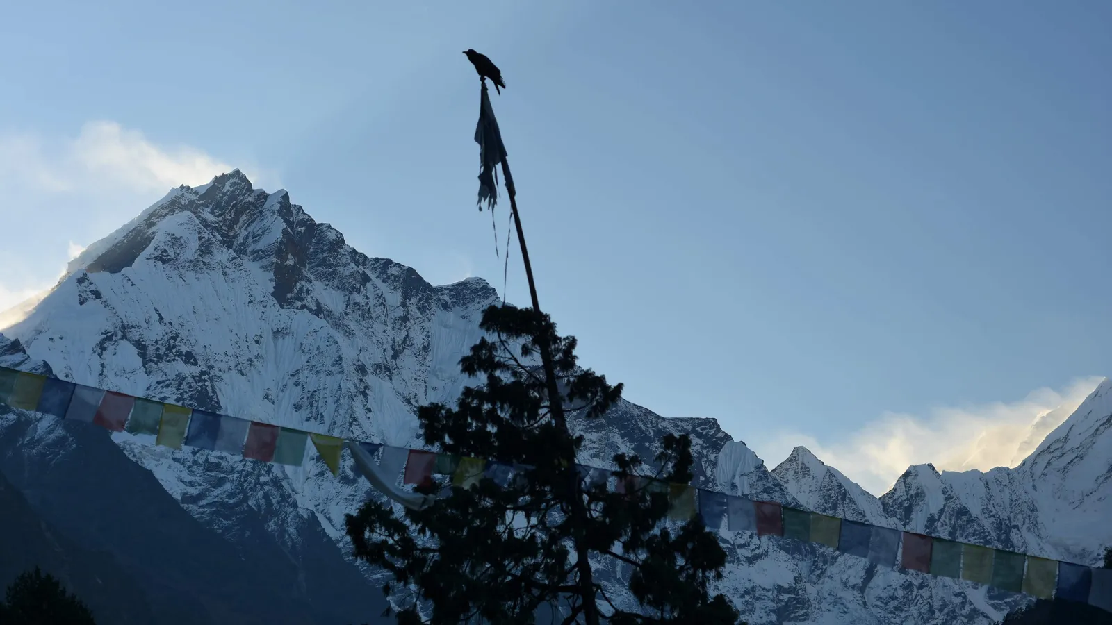 Prayer Flags at Dusk
A bird perches atop a prayer flag pole silhouetted against snow-capped peaks as colorful flags flutter in the evening light.