Highlights
- Explore Lo Manthang, the ancient walled capital of the Kingdom of Lo.
- Trek through dramatic desert landscapes unique to the trans-Himalayan region.
- Visit Chosar Cave and discover centuries-old artifacts and artwork.
- Experience authentic Tibetan Buddhist culture in remote villages.
- Follow the historic salt trade route along the Kali Gandaki River.
- Stay with a local family in Barang Village for a community homestay experience.
Upper Mustang Trek
The Upper Mustang Trek is a journey into one of the last truly remote regions of the Himalayas. Known as the “Last Forbidden Kingdom,” this high-altitude desert was closed to outsiders until 1992, preserving a way of life that has remained unchanged for centuries. Today, a special permit allows trekkers to explore this hidden corner of Nepal, where Tibetan culture thrives in an almost lunar landscape of eroded cliffs, deep canyons, and ancient cave dwellings.
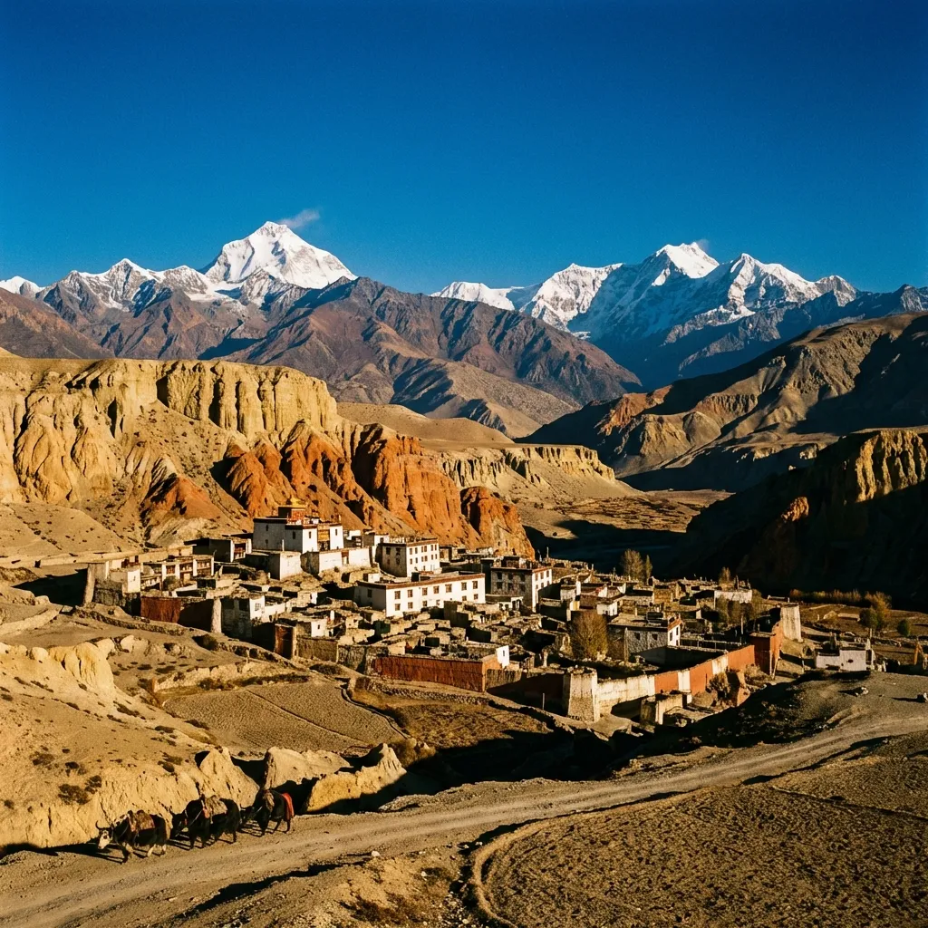
The trek follows the historic salt trade route from Kagbeni through the upper Kali Gandaki valley. As you ascend, the green valleys of the lower Annapurna region give way to a stark, wind-sculpted terrain painted in shades of ochre, rust, and cream. The journey culminates at Lo Manthang, a walled city that was once the capital of the Kingdom of Lo. Within its medieval walls, whitewashed monasteries house priceless Buddhist treasures, and residents continue traditions passed down through countless generations.
This 19-day adventure combines the cultural immersion of Lo Manthang with a community homestay experience in Barang Village, where you’ll participate in daily village life and witness traditional farming practices. The trek concludes with sightseeing in Kathmandu, visiting UNESCO World Heritage Sites that showcase Nepal’s rich artistic and spiritual heritage.
Route Map
Itinerary
Day 1: Arrival in Kathmandu
Rest | Elevation: 1,305m
Welcome to Nepal. Our representative will greet you at Tribhuvan International Airport and transfer you to your hotel. Depending on your arrival time, explore the vibrant streets of Thamel or rest before the adventure begins.
Day 2: Drive to Pokhara
Kathmandu → Pokhara
Drive: 10 hours | Elevation: 820m
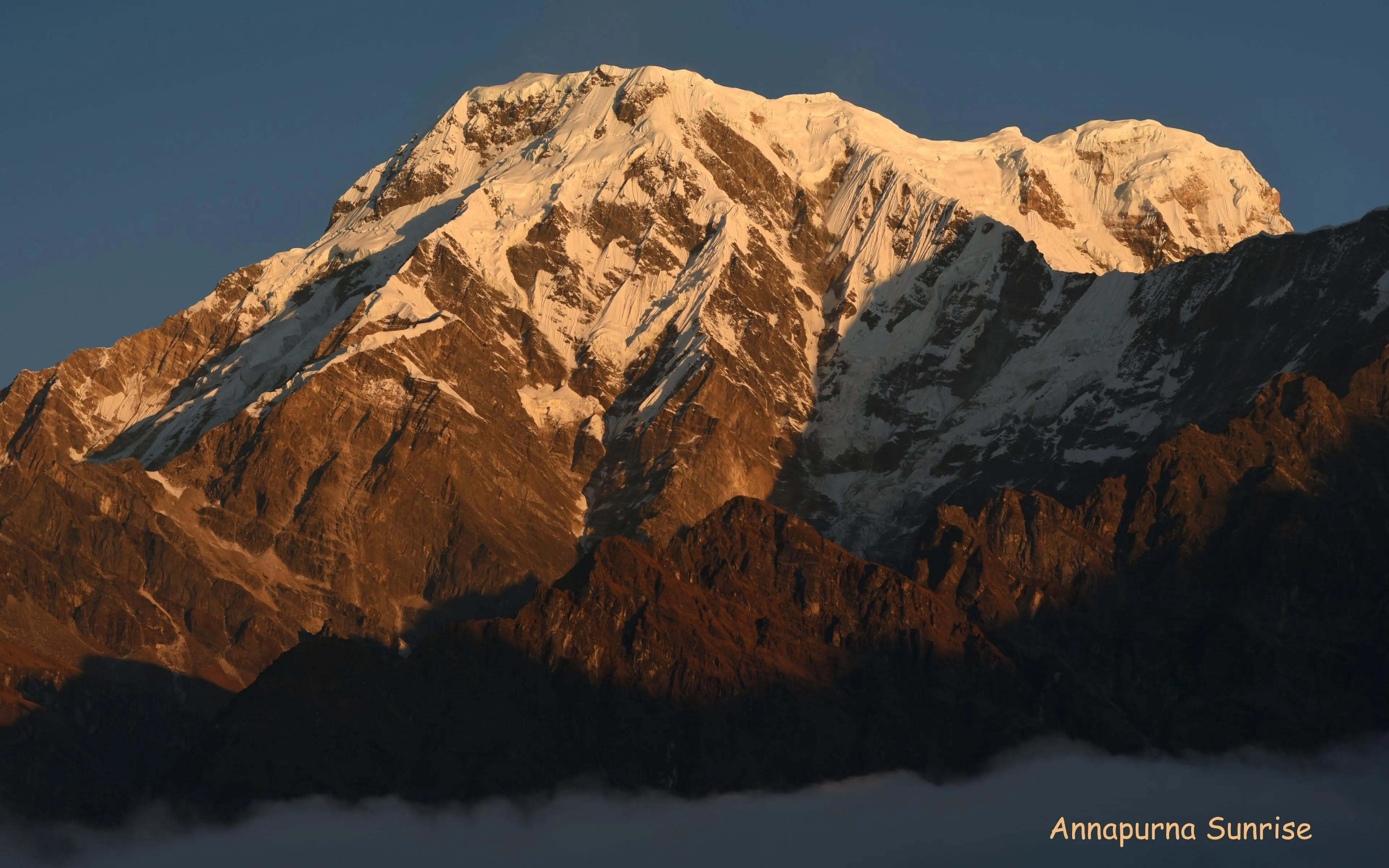
The journey to Pokhara follows the Prithvi Highway along the Trishuli River. The road winds through hill country, passing terraced fields and small market towns. Arriving in the afternoon, you'll have time to stroll along the shores of Phewa Lake and enjoy views of the Annapurna range reflected in its waters.
Day 3: Drive to Kagbeni
Leg 1: Pokhara → Kagbeni
Drive: 9 hours | Elevation: 2,804m
An early start takes you north through the Kali Gandaki gorge, the deepest canyon on Earth. The landscape transforms dramatically as you leave the green hills behind and enter the arid rain shadow of the Himalaya. Kagbeni, with its medieval mud-brick buildings and narrow alleyways, marks the gateway to Upper Mustang.
Day 4: Trek to Chhusang
Leg 2: Kagbeni → Tangbe
Trek: 2 hours | Elevation: 3,060m
After checking your special trekking permit, the trail follows the Kali Gandaki riverbed north. The path is sandy and windswept, with views of Nilgiri and Tukuche behind you. Pass through Tangbe village, with its narrow lanes and apple orchards.
Leg 3: Tangbe → Chhusang
Trek: 3 hours, 5 km | Elevation: 2,980m
Continue to Chhusang for the night.
Day 5: Trek to Samar
Leg 4: Chhusang → Ghyakar
Trek: 3 hours, 6 km | Elevation: 3,200m
Today's route climbs away from the river through red and ochre cliffs. You'll pass ancient cave dwellings and cross suspension bridges before ascending to Ghyakar, with its terraced fields and traditional stone houses.
Leg 5: Ghyakar → Samar
Trek: 3 hours, 6 km | Elevation: 3,660m
The trail continues through increasingly dramatic terrain to Samar.
Day 6: Trek to Syangboche
Leg 6: Samar → Yamda La Pass
Trek: 4 hours, 8 km | Elevation: 3,850m
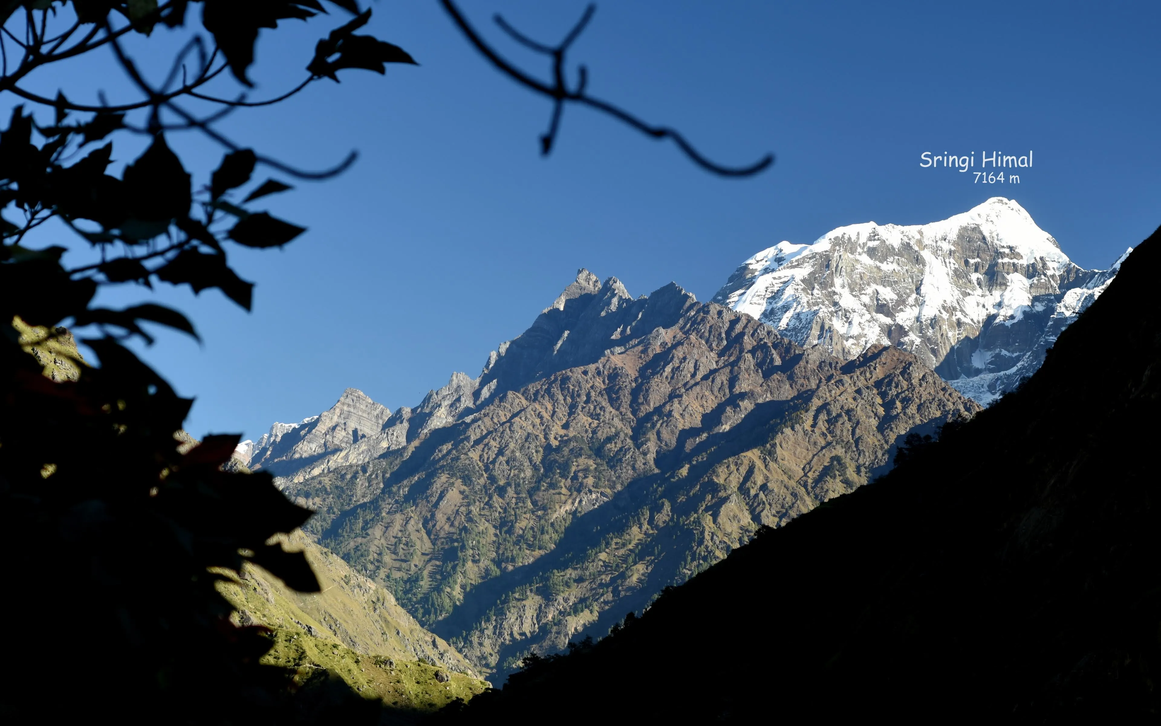
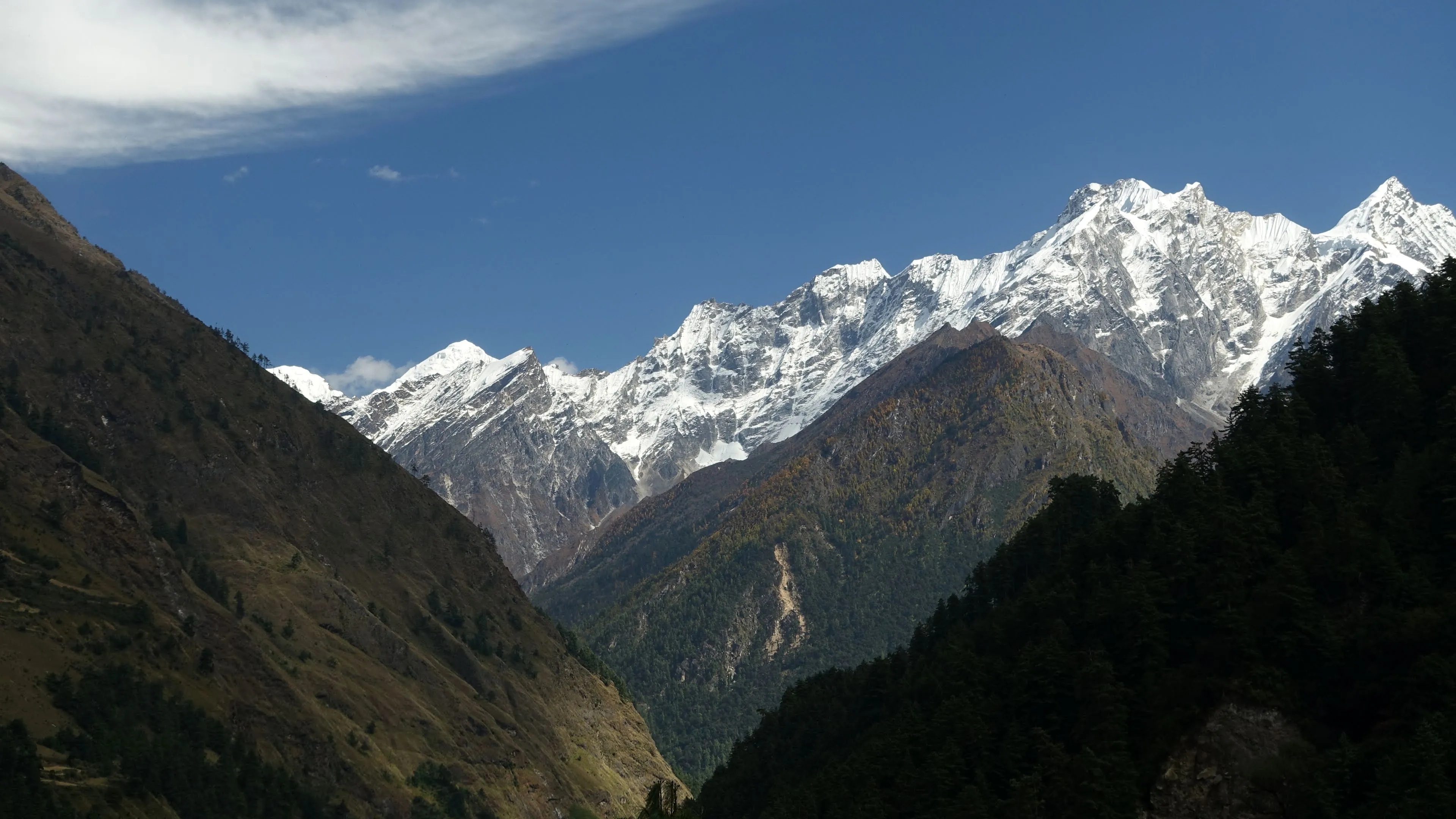
The trail descends through juniper and pine forest before climbing to the Yamda La Pass (3,850m), where views of Dhaulagiri and Annapurna reward your effort.
Leg 7: Yamda La Pass → Syangboche
Trek: 2 hours, 5 km | Elevation: 3,800m
Continue through a landscape dotted with chortens and mani walls to the small settlement of Syangboche.
Day 7: Trek to Dhakmar
Leg 8: Syangboche → Ghami
Trek: 3 hours, 8 km | Elevation: 3,520m
After crossing another pass, descend into a lush valley before climbing to Ghami, one of the largest villages in Upper Mustang.
Leg 9: Ghami → Dhakmar
Trek: 3 hours, 6 km | Elevation: 3,820m
The final stretch leads to Dhakmar, named for its striking red cliffs that glow in the afternoon light.
Day 8: Trek to Lo Manthang
Leg 10: Dhakmar → Ghar Gompa
Trek: 2 hours, 5 km | Elevation: 3,950m
The defining day of the trek. Visit the ancient Ghar Gompa monastery.
Leg 11: Ghar Gompa → Chogo La Pass
Trek: 2 hours, 5 km | Elevation: 4,325m
Cross the Chogo La Pass at 4,325m. The descent offers sweeping views of the Mustang valley.
Leg 12: Chogo La Pass → Lo Manthang
Trek: 3 hours, 8 km | Elevation: 3,840m
Gradually the walls of Lo Manthang appear on the horizon—a medieval city frozen in time.
Day 9: Trek to Chosar
Leg 13: Lo Manthang → Chosar
Trek: 4 hours, 8 km | Elevation: 3,900m
A day trip to explore the mysterious Chosar caves, carved into towering cliffs. These caves once served as dwellings, meditation chambers, and burial sites, and contain remnants of ancient artwork. The landscape here feels otherworldly, a desert moonscape at the edge of Tibet.
Day 10: Return to Lo Manthang
Leg 14: Chosar → Lo Manthang
Sightseeing: 6 hours | Elevation: 3,840m
Return to Lo Manthang for deeper exploration. Wander the narrow alleys within the city walls, visit the four main monasteries—Jampa, Thubchen, Chodey, and Choprang—and observe the daily rhythms of life in this remarkable place.
Day 11: Trek to Yara
Leg 15: Lo Manthang → Dhi
Trek: 4 hours, 13.3 km | Elevation: 3,400m
Depart Lo Manthang via an alternate route, passing through Dhi Village.
Leg 16: Dhi → Luri Gomba
Trek: 2 hours, 4 km | Elevation: 3,700m
Visit the cave monastery of Luri Gomba, renowned for its ancient wall paintings.
Leg 17: Luri Gomba → Yara
Trek: 2 hours, 6 km | Elevation: 3,650m
Continue to Yara, a village of flat-roofed houses surrounded by dramatic cliffs and rock formations.
Day 12: Trek to Tangya
Leg 18: Yara → Tangya
Trek: 6 hours, 6 km | Elevation: 3,240m
The trail winds through barren hillsides dotted with cave dwellings. As you descend, the stark desert terrain softens slightly. Tangya village offers a glimpse into the resilient lifestyle of Upper Mustang's people.
Day 13: Trek to Chhusang
Leg 19: Tangya → Chhusang
Trek: 7 hours, 10 km | Elevation: 2,980m
Continue retracing the route through varied terrain, enjoying new perspectives on the dramatic landscapes you passed on the way up. The village of Chhusang provides a comfortable stop before the final descent.
Day 14: Drive to Barang Village
Chhusang → Barang Village
Drive: 9 hours | Elevation: 1,400m
A long but scenic drive takes you from the high desert back through the lush valleys of the Annapurna region. Arriving at Barang Village, you'll be welcomed into a local family's home for an authentic community homestay experience.
Day 15: Community Experience in Barang
Sightseeing: — | Elevation: 1,400m
Immerse yourself in village life. Join your hosts in traditional farming activities, learn about local crafts, and explore the surrounding hills with their views of the Annapurna range. Evening brings traditional music and cultural exchange.
Day 16: Full Day in Barang
Sightseeing: — | Elevation: 1,400m
A second day to deepen your connection with the community. Participate in cooking traditional meals, visit neighboring households, or simply relax and absorb the peaceful rhythm of rural Nepal.
Day 17: Fly to Kathmandu
Barang Village → Kathmandu
Flight: 1 hours | Elevation: 1,305m
Transfer to Pokhara airport for the short flight to Kathmandu. The rest of the day is free to explore the city's temples, markets, and restaurants.
Day 18: Kathmandu Sightseeing
Sightseeing: — | Elevation: 1,305m
A full day of cultural exploration. Visit Kathmandu Durbar Square with its ancient temples, the hilltop Swayambhunath Stupa (Monkey Temple), and the sacred Pashupatinath Temple along the Bagmati River. A farewell dinner celebrates the completion of your journey.
Day 19: Departure
Rest | Elevation: 1,305m
Transfer to the airport for your onward journey, carrying memories of forbidden kingdoms, ancient monasteries, and the timeless landscapes of Upper Mustang.